Showing posts with label Stage 2. Show all posts

Kington to Knighton

22 May 2010 - Kington to Knighton

Distance - 15.1 miles
Weather - Sunny
We stayed at - The Horse & Jockey Inn, Wylcwm Place, Knighton, Powys, LD7 1AE  Cost - £75.00


Today was our last walking day. After crossing the busy A44, we climbed up a steep lane to Kington Golf Club, which is alleged to be the highest golf club in England at 1,284 feet (390 metres). It was very pretty in any case. It seemed odd that it was in England because only a few minutes before we had been in Wales! Just after we arrived at Bradnor Green we got lost. I started following a national trail, but  didn't pay enough attention and unfortunately it was the Mortimer Trail and not the Offa's Dyke Path. Of course the mistake had been all uphill and we had to lose that height to find the correct path! Anyway we rejoined the Dyke itself and headed round Rushock Hill to Herrock Hill. The scenery at this point was beautiful, with interesting little rounded hills surrounded by unspoiled countryside.


The day carried on in much the same vein. It was good to have the Offa's Dyke actually with us for most of the day, as for much of the last three days we hadn't seen it at all! On reaching Hengwm Hill we came across an obelisk, surrounded by sheep, which commemorated Sir Richard Green Price who brought the railways to Radnorshire. We paused in this beautiful green field for a rest and a sunbathe before continuing along more of Offa's Dyke. Pretty soon we reached a woodland, which came out on a tarmac path high above Knighton. We then gradually descended into the town.

Our room at the Horse & Jockey was really gorgeous, a huge contemporary room in an annexe to the pub. It had a huge bedroom & bathroom and we felt the price was a bit of a bargain. The pub served some lovely food and we sat outside at a table with a group of walkers we encountered each of the last few days. They were all going on to finish the Offa's Dyke Path, whilst we were off home. It was a great evening and we didn't go to bed very early.

The next day we had to hang about until 14:20 to catch the train to Shrewsbury, but we were able to reflect on all the different landscapes we had travelled through on this leg - Exmoor, Somerset Levels, the Quantocks, the Black Mountains of Wales & Offa's Dyke. The owners of the pub were great and let us stay in our room for longer than we should have. From Shrewsbury we caught the train to Crewe and at Crewe caught the train to Carlisle. From Carlisle we made our way to Glasgow Central, then walked over to Glasgow Queen Street for our final train home to Stirling, arriving at 21.54. A standard single from Knighton to Stirling had been astronomical, costing about £234.00. Curiously by buying a single from Knighton to Shrewsbury and from Shrewsbury to Stirling, we managed to virtually halve the cost and travel first class! I'll never understand National Rail's pricing structure!

Cost of train travel for two adults: -
Knighton to Shrewsbury - £31.40
Shrewsbury to Stirling - £99.00 (first class)

Hay-on-Wye to Kington

21 May 2010 - Hay-on Wye to Kington

Distance - 14.7 miles
Weather - Sunny
We stayed at - Swan Hotel, Church Street, Kington, Herefordshire, HR5 3AZ  Cost - £60.00

We left Hay-on-Wye by the Clyro road and Hay Bridge, where there was a beautiful view up the river. The was also a small group of elderly gentleman on the bridge and we stopped to listen to them talk about their childhood and generally growing up in Hay-on-Wye. They pointed out to us how the course of the river had changed over time. It was a lovely nostalgic start to the day. We walked alongside the river for a bit and decided that we should put on some sun tan lotion as the sun was rather strong. I took off my wedding ring and three engagement rings and laid them on the top of my rucksack whilst I applied the sun cream. When I finished, I picked up my rucksack, only to see my rings scatter all over the grass and hedgerow. We found three of them fairly easily and eventually found the fourth, before I shed too many tears. From that day forward I started giving Alistair my rings to hold or zipped them up in a pocket of my walking trousers!

After a short while we left the River Wye, then followed field edges and tracks until we reached the busy A438, where we had to walk down the verge for around three quarters of a mile before we met a little lane taking us up to Bettws Dingle. From there it was all rural tranquility to Newchurch, where we climbed up to Disgwylfa Hill and descended to Hill House Farm House, where we helped ourselves to some water from their tap. The guide book said there had been a verse inviting walkers to take a drink, but there wasn't anything there on the day we arrived. Just as we were filling our water bottles a farm worker appeared, but he never said anything to us. We were a bit embarrassed and shuffled off quite quickly! The countryside around here was just perfect - small rolling hills surrounded by greenery. The pub at Gladestry was conveniently open when we passed, so we headed into its cool interior for a swift half and a chat with the friendly locals.

After Gladestry we headed up onto the Hergest Ridge, where there were even more lovely views and the walking quite easy once you reached the top. Near the middle of the ridge we were told you could see the curving tracks of the former Kington racecourse, although I'm not sure we actually did see them. We did recognise the large glacial boulder called the Whet Stone. From the ridge we descended onto a narrow country lane, passing by the entrance to Hergest Croft Gardens. We also passed a very bold sign that claimed Kington was "The Centre for Walking", whatever that might mean! Finally we reached The Square and our hotel for the night - The Swan.


Pandy to Hay-on-Wye

20 May 2010 - Pandy to Hay-on-Wye

Distance - 16.2 miles
Weather - Overcast but dry
We stayed at - Rest For The Tired, 6 Broad Street, Haye-on-Wye, Herefordshire, HR3 5DB Cost - £55.00

At breakfast the next day, the owner of the B&B said that he would show us a way through his back garden onto the Offa's Dyke path, to avoid the mile and a half or so we would otherwise have had to take to retrace our steps from last night. This involved him leading us down to the last cultivated bit of his land and pointing vaguely up a very overgrown hill and bidding us farewell, whilst advising us not to spook his neighbour's alpacas! If there was a path, we didn't see it and were left to battle through a lot of overgrown trees and grass tussocks. As the hillside was quite steep, we couldn't really see where we were making for, but eventually we came across a big chain link fence, which we managed to haul ourselves over - remember all of this was achieved with full rucksacks! From there we crossed a field of alpacas and finally met up with a gate which led us onto the Offa's Dyke path. Whilst it saved us a good mile and a half of walking, I'm still not convinced we expended any less effort by using the short cut! 

This day's walk was all about the Black Mountains, in particular Hatterrall Ridge. We had been warned that it was a very exposed section and that it ought not to be attempted if the weather was poor. Luckily for us, although the weather was a bit overcast, it was also dry and warm. 

After crossing a narrow lane, we made our way up to the Pentwyn Iron Age hill fort, followed by a large walled enclosure known as The Castle. It was then a steep climb up to the trig point at the first summit at 1,521 feet (464 metres) on Hatterrall Hill. For around seven miles we gradually climbed the long ridge until we reached a further trig point at 1,810 feet (552 metres). There were lots of cairns up here, near Black Darren and Alistair and I took turns to add our own stone to each one. We carried on walking along the ridge, marvelling at the spectacular views until we reached our highest point at 2,306 feet (703 metres), which was the highest we had climbed so far on our LEJOG. 

We gradually descended from the summit to Hay Bluff at 2,219 feet (677 metres), where we were met by spectacular views north over Hay and the Wye Valley with the South Radnorshire hills beyond. It was a truly breathtaking sight. We lingered here a while before making our very steep decent down to the car park at the base of the hill. On the way down we encountered a number of ponies, each with tiny foals in tow. We then walked to the steep west side of Cusop Dingle and finally arrived at Hay-on-Wye - every book lover's dream destination! Our guest house was a beautiful old black and white building, with the accommodation above a book shop. We were right in the eves and our room was very quaint and characterful. Once we'd deposited the rucksacks, Al and I had a look round the town, which was a mouth-watering experience for two book lovers. It was only the thought of the added weight in our rucksacks that prevented us from buying a few!


Monmouth to Pandy

19 May 2010 - Monmouth to Pandy

Distance - 18.1 miles
Weather - Dry but overcast
We stayed at - Brynhonddu Country House B&B, Brynhonddu, Bwlch Trewyn Estate, Pandy, Avergavenny, Monmouthshire NP7 7 PD Cost - £65.00

We left Monmouth via its historic main street, after stocking up on drinks and food. We crossed the Monnow Bridge and exited the town via Watery Lane. We then had a relatively steep climb up to the top of Kings Wood, where thoughtfully some forestry work had recently been completed and we were able to appreciate some good views. From there it was downhill for a while to Lower Hendre Farm. I'm very keen on pigs, so I was delighted to encounter four little piggies rooting about on the footpath near the farm. They ran squeaking off into the undergrowth as soon as they saw us approach!

Just before Llanvihangel-Ystern-Llewern (St Michael's of the Fiery Meteor) the path followed a narrow lane, where of course we came across the largest tractor ever and had to squeeze up against the hedge as tight as we could to let it go past. For today only, we spent a lot of time either crossing or by the River Trothy and a pleasant stream it is too. We left the route of the Offa's Dyke footpath here to take a punt on whether a pub on our map at Tal-y-coed was open or not. We thought we could use a footpath, but "the map is not the territory" and the footpath was completely non-existent and worse, led us into a marsh, so we had to return to walk on the road to get there. Luckily for us though a) it was a pretty pub b) it was open c) it served great food.

Suitably refreshed, we continued on to White Castle, with vistas over to the Skirrid on the way. The path went about two thirds of the way around the castle and so we didn't pay to go in and look round. Instead we stopped in a nearby field and had a little bit of a rest before pressing on to the brilliantly named Caggle Street. The rest of the route to Pandy was through verdant Spring pastures, with an ever expanding view of the Black Mountains in front of us. 

When planning our LEJOG I decided, since we were walking the route in stages, it just wouldn't be complete unless we visited all three of Britain's mainland countries. Also a previous holiday in the Forest of Dean had introduced me to the Black Mountains and I had vowed to myself that one day I would come back and walk them.

Pandy was a small village strung along the busy A465 and wasn't really anything to write home about. I hadn't been able to find any accommodation there and so we walked a little further to Brynhonddu Country House B&B. The accommodation was lovely and as we'd had a big meal at lunchtime in the pub, we just snacked on the food we had bought in Monmouth that morning. We lay on the bed, until the sun went down, watching the lambs frolicking about on the sloping hillside outside. 


Chepstow to Monmouth

18 May 2010 - Chepstow to Monmouth

Distance - 16.7 miles
Weather - Sunny
We stayed at - Bistro Prego, 7 Church Street, Monmouth, Monmouthshire, NP25 3BX Cost - £60.00

The next morning when we went to check out of the Castle View Hotel we found that the manager had not added our evening meal and drinks onto our bill. Being honest we pointed this out to the member of staff on duty, who took my card number and said they would look into it. When we got home we found a copy of the card transaction waiting for us, without so much as a thank you written on it!

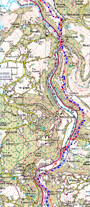
Feeling a bit more refreshed than last night, we took a little time to look round the outside of Chepstow Castle before heading on our way over an old bridge over the River Wye. We were going to be close to the River Wye all day today. I must confess to loving the countryside around the Wye Valley and the Forest of Dean and found it really difficult to choose a single path through all this lovely scenery when I was planning our LEJOG. We decided in the end though, to simply follow the Offa's Dyke for the next few days up to Knighton. We used the National Trail Guide, Offa's Dyke Path South - Chepstow to Knighton for this part of the journey.

The first place of note we reached was the lovely Wintour's Leap, which is named after the Royalist Sir John Wintour, who was meant to have leapt off the cliff to escape Parliamentary forces and after landing safely in the Wye, swam to Chepstow Castle. He sounds like a medieval James Bond and the plot is just as believable! 
The Offa's Dyke path continued through woodland and passed by the Devil's Pulpit, a large rock, which the Prince of Darkness used to preach from to try and corrupt the monks at nearby Tintern Abbey. I could see why he chose this spot, as there was a great view down to the abbey from here. After Brockweir and some refreshments, there was a choice of paths to follow, as it was a gorgeous day we took the longer, riverside walk up to Bigsweir Bridge. There we left the River Wye and headed into some heavily perfumed bluebell woods by a place called The Fence.

We gradually ascended quite a way until we reached Highbury Hill Farm with its curious battlemented buildings. There was a spectacular view of an old railway bridge near Redbrook, before a really steep descent through two fields and a further sixty-seven steps down to the village. We were meant to follow the Offa's Dyke path up to the Naval Temple and the Kymin, but we missed the turning and entered Monmouth by another route. Bistro Prego was a real find. We enjoyed a lovely meal, then just had to walk upstairs to bed!


Easton-in-Gordano to Chepstow

17 May 2010 - Easton-in-Gordano to Chepstow

Distance - 19.5 miles
Weather - Sunny, overcast later in the day
We stayed at - Castle View Hotel, 16 Bridge Street, Chepstow, Gwent, Wales, NP16 5EZ Cost - £77.00

Trying to leave the Days Inn Hotel was even harder than trying to arrive and we ended up crossing ditches and squeezing through hedges in order to reach the footpath that would lead us to the River Avon footbridge. The combination of motorway, train lines and docks didn't make it the most salubrious or prettiest of areas. We eventually reached the footbridge, which was essentially a bit of the M5 road bridge sheltered by some crash barrier and marveled at the contrast. One side it was very rural with fields, whilst the other side there were docks and industry. When we reached the end of the bridge we were no longer in Somerset, but in the City of Bristol. 

It was now that I was very grateful for the tips gleaned from the Cicerone End to End Trail guide, that suggested a route up through Kings Weston, giving us a green corridor through the city. Otherwise we would have had to plod through miles of housing estates to break free. Using their recommended route, with the exception of the traffic noise, you would be hard pressed to think you were anywhere near a big city. The route finished at the picturesque Blaise Hamlet, a tiny village built around a green, which was designed by John Nash in 1809 and built to house pensioners from the nearby Blaise estate.


After Blaise Hamlet we crossed the railway line and then the M5 again. At this point we had a great view of Filton Airfield, but we were spared the sound of any planes at all during this holiday, as it coincided with the issue of the ash cloud from the Icelandic volcano and all planes in UK airspace had been grounded.

Shortly after these crossings, we reached Spanorium Hill where we got a view of the new M4 across the River Severn. There is no footbridge on the new M4, so instead we had to cross using the old M4 (now the M48) motorway bridge a bit further upriver. The countryside between Compton Greenfield and Easter Compton was actually quite nice. A little while later, we crossed yet another train line, walked through some more green fields, then crossed over the M4 and continued on some more rural footpaths until we reached Aust and the M48.

We sat down and had a rest just before walking to the start of the M48 foot bridge. We were both quite tired by this point, as we had already walked about 17 miles with full rucksacks. This suspension bridge was built in the 1960s and is about two thirds of a mile long. We were glad that it was a still day, as it is often closed to traffic if it's a bit windy. The first half of the bridge was quite exciting, but after a while it was just tiring and it never looked like the land the other side was getting any closer. 

When we did reach the other side, we got a bit lost and it seemed to take forever to cover the final mile and a half to get into the centre of Chepstow. There were points then when I could have sat down and cried. I have to admit that I learnt a few lessons that day, namely to pack a lot less in future and never to walk over 18 miles with a full rucksack, unless it really couldn't be avoided. The GPS actually ran out of charge before we reached our hotel for the night, which was the lovely Castle View Hotel, overlooking Chepstow Castle. We had planned to take the bus out to the start of the Offa's Dyke footpath, once we got to the hotel, and walk back, but we were so tired we just had dinner and a drink. The official start of Offa's Dyke was left for another day.


Sandford to Easton-in-Gordano

16 May 2010 - Sandford to Easton-in-Gordano

Distance - 16.8 miles
Weather - Overcast
We stayed at - Days Inn Bristol Hotel, Gordano Service Area, Junction 19, M5 Motorway, Portbury, BS20 7XG Cost - £65.00

For our route from Sandford we made use of a disused railway track, which was once called the Strawberry Line, but was now known by the rather less intriguing title of the Cheddar Valley Railway Walk. The path skirted round the edge of Congresbury and up to Yatton, where it met up with a still functioning line. Someone had gone to great lengths to make this a good walk, by including informative signs and interesting wrought iron sculptured signs. We particularly liked one in the shape of a steam engine, which allegedly included all the things you could hope to see on the walk, including cyclists and runners. I can vouch that, it being a Sunday, we did see a fair few of those.

At Yatton we left the disused railway line and had to do a bit of pavement walking to North End, then took a footpath leading us to Kenn. After that, we picked our way via footpaths overlooking Clevedon on to Cadbury Camp. We stopped at the top to have some sweets and a bit of a rest, as this was quite a strenuous day with a full pack. From there we went on to Clapton-in-Gordano which had a nice pub where we stopped for a quick pint. It was here where the GPS decided to crash and wipe all the information we had amassed about our journey over the last eight days. Needless to say I was not amused.

It was interesting once we neared the services at Easton-in-Gordan, where we were going to stay that night, as obviously everyone arrives by car, so there were no facilities for anyone arriving by foot. We managed to reach the car park without being ran over and to find the motel. It was really funny watching all the travelers queuing for the burger bars and toilets, all in a rush to get back on the road, whereas we had all the time in the world. Whilst it wasn't the best place we've stayed, it did give us a reasonably cheap and efficient roof over our heads that night.

Stoughton to Sandford

15 May 2010 - Stoughton to Sandford

Distance - 17.2 miles
Weather - Sunny
We stayed at - Sandford Cottage B&B, Station Road, Sandford, Winscombe, Avon, BS25 5RA Cost - £45.00

The next day we left the Somerset levels and set off along lovely lush meadows filled with flowers to Brinscombe Hill, where there was a great view over to Cheddar and the Cheddar reservoir. From this vantage point, we could also see the slightly mystical Nyland Hill to the east. The route I've included shows that we had planned to walk along the Cheddar Yeo to Cheddar, but actually we took the footpath to the reservoir and walked around the top, emerging a little later on at a car park. The reservoir was huge and as this was a sunny Saturday, everyone seemed to be out on it doing everything from fishing to sailing.

We wandered through Cheddar and had lunch at a cafe there before taking the footpath over the top of Cheddar Gorge. At the start of the walk there was a wooden observation tower, giving good views back over the Levels and Cheddar itself. Although I've been to Cheddar a couple of times before, I had never walked by the top of the gorge before and the views were simply breathtaking. I was also delighted to stumble upon a slow worm basking itself in the sun, as it was several years since I'd last seen one of these lizards.

As we came down from Cheddar Gorge to Black Rock we crossed a deliciously scented bluebell wood, then the route took us up to Beacon Batch and across to Dolebury Warren. There was an Iron Age fort at the end of Dolebury Warren, but sadly the path went straight through, rather than round the fort. The views from here though were excellent. 

From Dolebury Warren there was a fairly straightforward walk down to Sandford via Lyncombe Hill. The owner of Sandford Cottage B&B had been extremely kind and let us stay even though she was off to a wedding. She left us a really nice continental breakfast and knocked some money off the usual price because she couldn't do us a full English. The accommodation was really lovely - we were in more of a holiday cottage than a B&B. I was so grateful she let us stay, as finding accommodation around this part of the country had been difficult. To top it all, her cottage was opposite a really good pub, where we had a lovely evening meal.


Bridgwater to Stoughton

14 May 2010 - Bridgwater to Stoughton

Distance - 15.8 miles
Weather - Dry, but overcast
We stayed at - Poplar Farm, West Stoughton, Wedmore, Somerset, BS28 4PP Cost - £60.00


The whole reason for choosing the route we followed for this stage of the LEJOG was to have as much variety as possible in the scenery and our surroundings. First of all we had experienced the beautiful Devon countryside, followed by Exmoor and the Quantock Hills. Today we left the hills behind and walked through the Somerset Levels, which in contrast to yesterday, rarely took us above sea level. Since the land often floods, there are few public footpaths, so most of our walking was on narrow lanes or farm tracks. We spent a good while negotiating ourselves out of Bridgwater, but finally we left the footbridge over the M5 and walked into the little village of Chedzoy.

A bit further on we followed a footpath along the incredibly straight King's Sedgemoor Drain up to Bawdrip. I had thought the Somerset Levels would be full of reed beds  but instead the landscape reminded me of the sluices found around Lincolnshire. It was then quite a fiddly route through Cossington to the pumping station at Gold Corner. The pumping station stood by the side of the Huntspill River, which for a river I had never previously heard of was extremely wide. Some old pumping machinery stood in the grounds of the pumping station.

From Gold Corner we walked on to meet the Cripps River and a bit later the River Brue. More fiddly routes led us to Westham and Blackford. There isn't really much around this area except for fields, drains and rivers and so to get some accommodation for the night we had to walk to West Staughton. We stayed in a lovely log cabin in the grounds of Poplar Farm. I much preferred sleeping out there, than with the other guests in the farmhouse itself. It was like a posh Wendy house, with even its own shower and toilet.